Proteus GNSS Receiver & Syslor AR/Digital Twin Platform
Sustainable building materials & equipment
Enabling real-time mapping and visualization of underground utility networks with centimeter precision to reduce excavation risks and eliminate the need for pre-existing plans.
Contact

Syslor (Syslor S.A.S.)
Company Established Year
Who is this solution for
Info
Available

Project Status
Looking to expand internationally
Doing business in
Awards and certifications
Solar Impulse Efficient Solution Label
Certified Proteus GNSS system for sustainable, cost-saving utility mapping.
CIRED Best Startup – Voted by Delegates
Named “Best Startup” at CIRED 2025 by industry attendees.
Product description
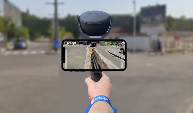
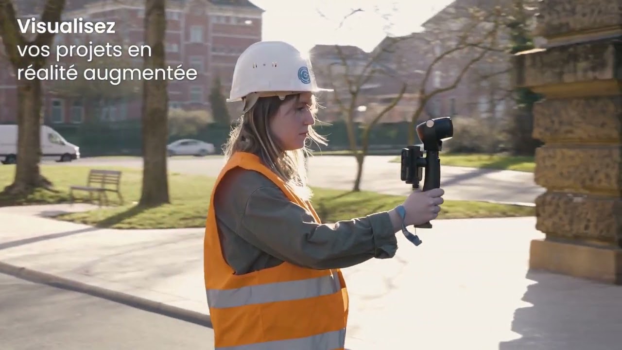
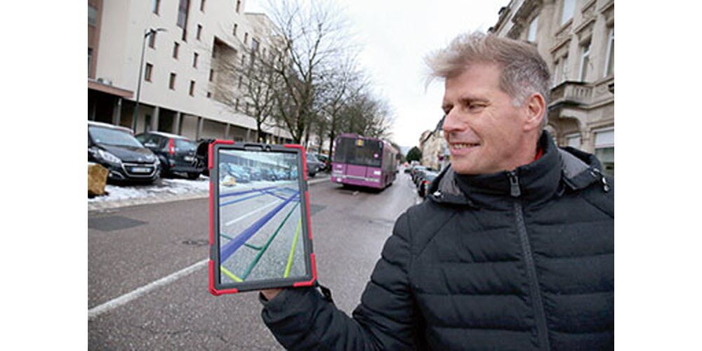
Syslor’s Proteus system revolutionizes the way underground utility networks are mapped and visualized by combining a rugged GNSS receiver with AR-enabled mobile applications. This innovative solution enables real-time mapping and visualization of underground utility networks with centimeter precision, reducing excavation risks and eliminating the need for pre-existing plans.
The Proteus system consists of a GNSS receiver that captures GPS coordinates with exceptional accuracy, tying into Syslor's suite of mobile applications. These apps include EasyField for staking, EasyScan for video-based as-built planning, and EasyView for overlaying georeferenced network models into augmented reality on smartphones. By leveraging these tools, users can visually chart buried infrastructure, enhancing safety and efficiency on utility projects.
Delivered as a cohesive hardware–software package, Syslor's Proteus system integrates seamlessly into utility workflows, providing certified, geometry-accurate plans directly from smartphone footage. This platform offers instant feedback to site crews and synchronizes data to a centralized portal for documentation, streamlining project management and reducing environmental impact from reworks.
Syslor's Proteus system is designed to support utility works, public infrastructure modernization, and smart city development. With a focus on ease-of-use, digital transparency, and field-accessible execution, this solution empowers surveyors, contractors, and municipalities to efficiently manage underground utility projects with precision and confidence.
Key characteristics and environmental benefits
- Real-time mapping and visualization of underground utility networks with centimeter precision
- Integration of rugged GNSS receiver with AR-enabled mobile applications
- Elimination of pre-existing plans and reduction of excavation risks
- EasyField, EasyScan, and EasyView apps for staking, as-built planning, and augmented reality visualization
- Geometry-accurate plans directly from smartphone footage
- Instant feedback to site crews and data synchronization to a centralized portal
- Enhanced safety, reduced project durations, and lower environmental impact from reworks
- Support for utility works, public infrastructure modernization, and smart city development
- Focus on ease-of-use, digital transparency, and field-accessible execution
About the Company
Ask about Proteus GNSS Receiver & Syslor AR/Digital Twin Platform
Hi there! I’m here to help you quickly understand what this green solution is about — without needing to read the full page.
You can ask me things like:
- What problem does it solve?
- How does it help the environment?
- What makes it different?
Let’s explore together!
You can try asking:
Oops, it seems like you're not a member.
Sign up! It's free. You'll be able to read all the articles you like, download PDFs, and get in contact with the respective owners.
Have an account already? Sign in here